TITLE: Planning cycle routes in Washington DC
DATE: 2025-05-03
AUTHOR: John L. Godlee
====================================================================
Having moved to Washington DC for work, I have spent some time
looking at potential bike routes around the city. I brought my
Dawes Super Galaxy touring bike rather than the single-speed, so I
can do some riding on gravel trails. These routes are all longer
rides. I think the shorter rides around town will emerge
organically as I ride more. All these routes are adaptations of
existing routes that others have posted online through websites
like Komoot, ridewithgps, and bikewashington.org. I haven't tested
any of the routes yet, but I hope to try at least the three shorter
ones over the next few weeks. As in my post about Edinburgh bike
routes, I calculated the length of each route using R.
[work]: /posts/work/2025-04-08-geotrees_job_talk
[single-speed]: /posts/2023-08-12-bike_refurb
[Komoot]:
https://www.komoot.com/
[ridewithgps]:
https://ridewithgps.com/
[bikewashington.org]:
http://www.bikewashington.org/
[Edinburgh bike routes]:
/posts/personal/2024-10-27-cycle_edinburgh
Arlington Loop
GPX track
[GPX
track](
https://johngodlee.xyz/files/dc_bike_routes/arlington_loop.gp
x)
Length: 29.6 km, 18.4 miles
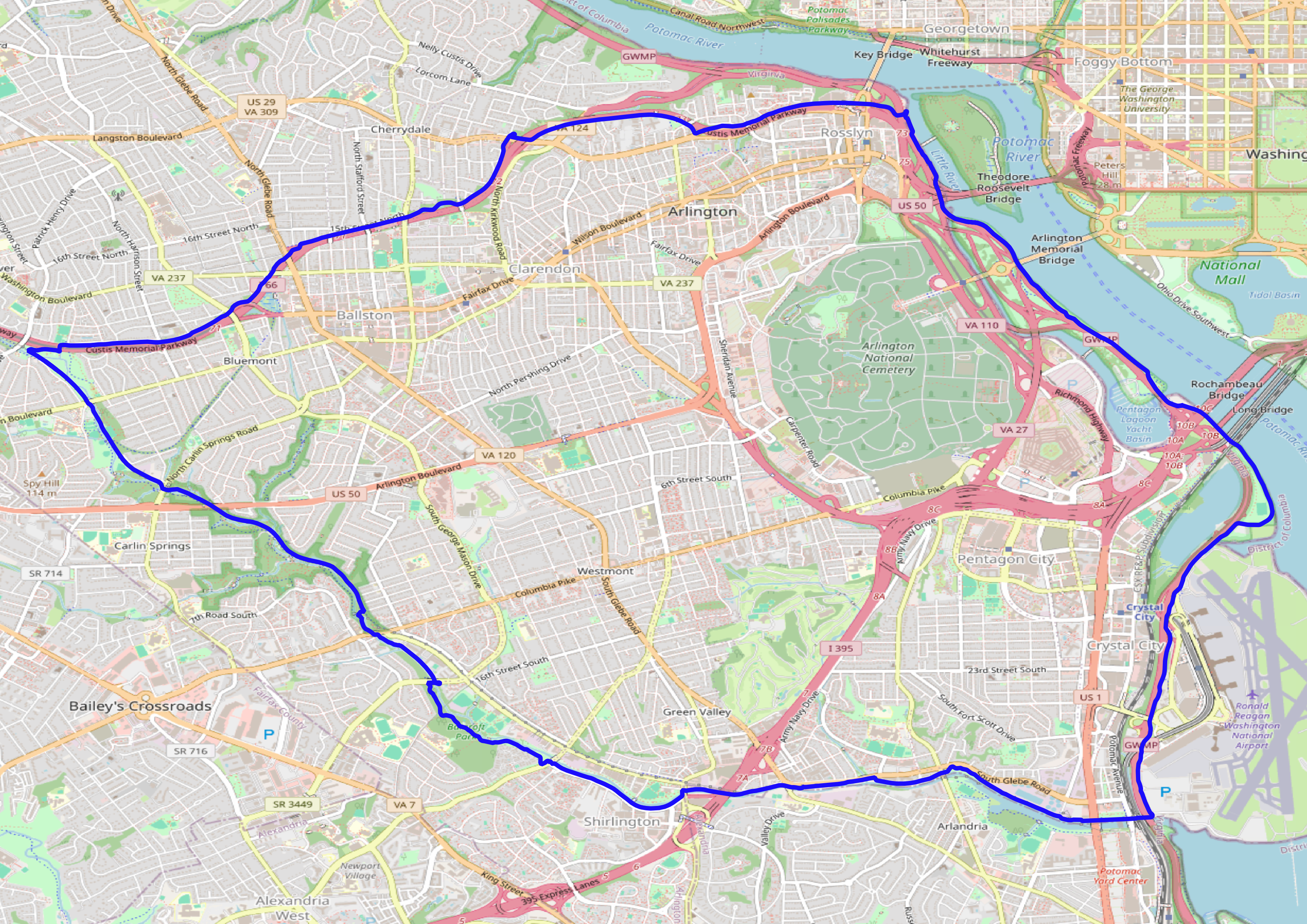
Recommended by both bikewashington.org and bikearlington.com. This
loop follows the Mt. Vernon Trail down the Potomac river, then west
along the Four Mile Run Trail, switching to the W&OD Trail, and
finally back east along the Custis Trail, mostly avoiding roads.
[bikearlington.com]:
https://www.bikearlington.com
DC Zoo Loop
GPX track
[1](
https://johngodlee.xyz/files/dc_bike_routes/dc_zoo_loop.gpx)
Length: 33.3 km, 20.7 miles
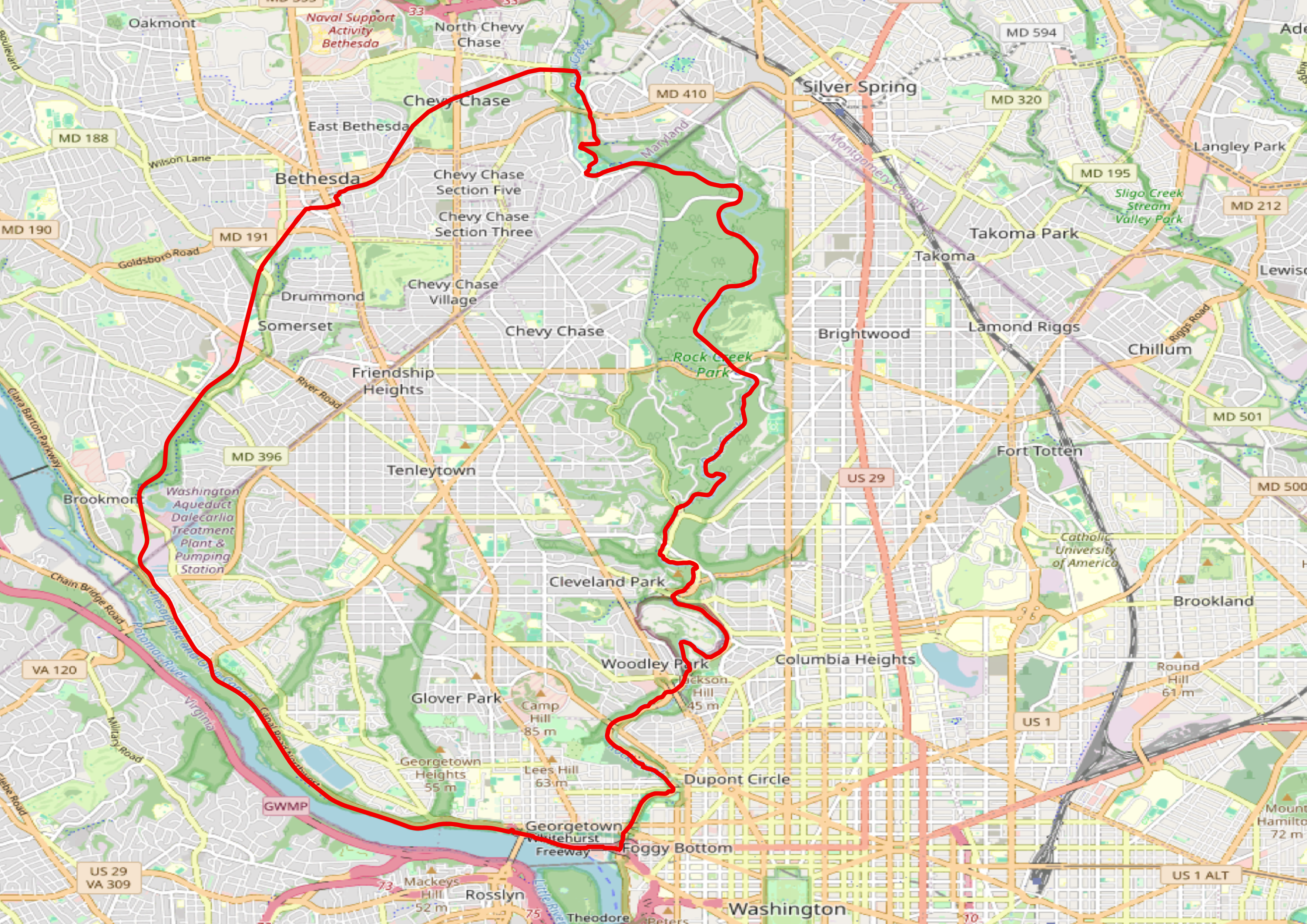
This loop appears in various guises on Komoot, ridewithgps and
bikewashington. The route follows the Rock Creek Park Trail going
north, then connects through Chevy Chase and Bethesda on the
Capital Crescent Trail down to Georgetown. It seems like this is a
very popular route. The northern part of the trail varies a bit
among sources, with some missing out Chevy Chase. Along the portion
which runs along the Potomac river it is also possible to follow
the C&O canal trail.
Anacostia Climbs
GPX track
[2](
https://johngodlee.xyz/files/dc_bike_routes/anacostia_climbs.gpx
)
Length: 112.5 km, 69.9 miles
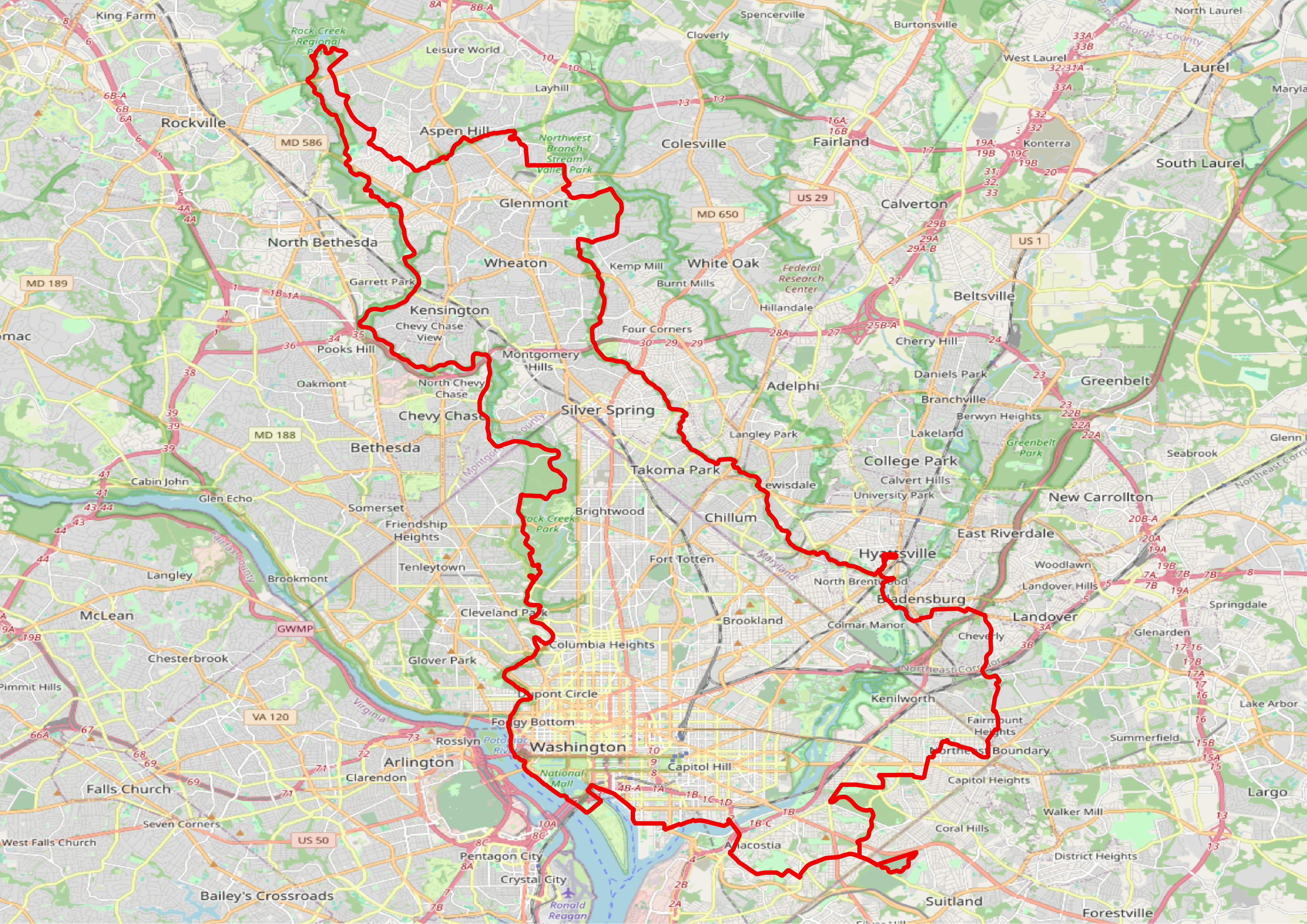
This route is a lot longer than the first two, but is still a loop.
It has more bits on roads, and is generally more complicated to
follow. I think I'll need a GPS unit or to have my phone attached
to the handlebars to navigate this one. The route came off Komoot,
and has some weird detours which I think might have resulted from
the original rider getting lost. The trail takes advantage of the
Anacostia River Trail up through Hyattsville all the way to Wheaton
Regional Park, then uses the Matthew Henson Trail to connect to the
top end of the Rock Creek Park Trail, which it follows all the way
down to Georgetown. The bit from 11th Stree Bridge to Hyattsville
looks most complicated, and I wonder why they didn't follow the
Anacostia River Trail for that bit as well.
C&O Canal Trail
GPX track
[3](
https://johngodlee.xyz/files/dc_bike_routes/co_tow_path.gpx)
Length: 297 km, 185 miles
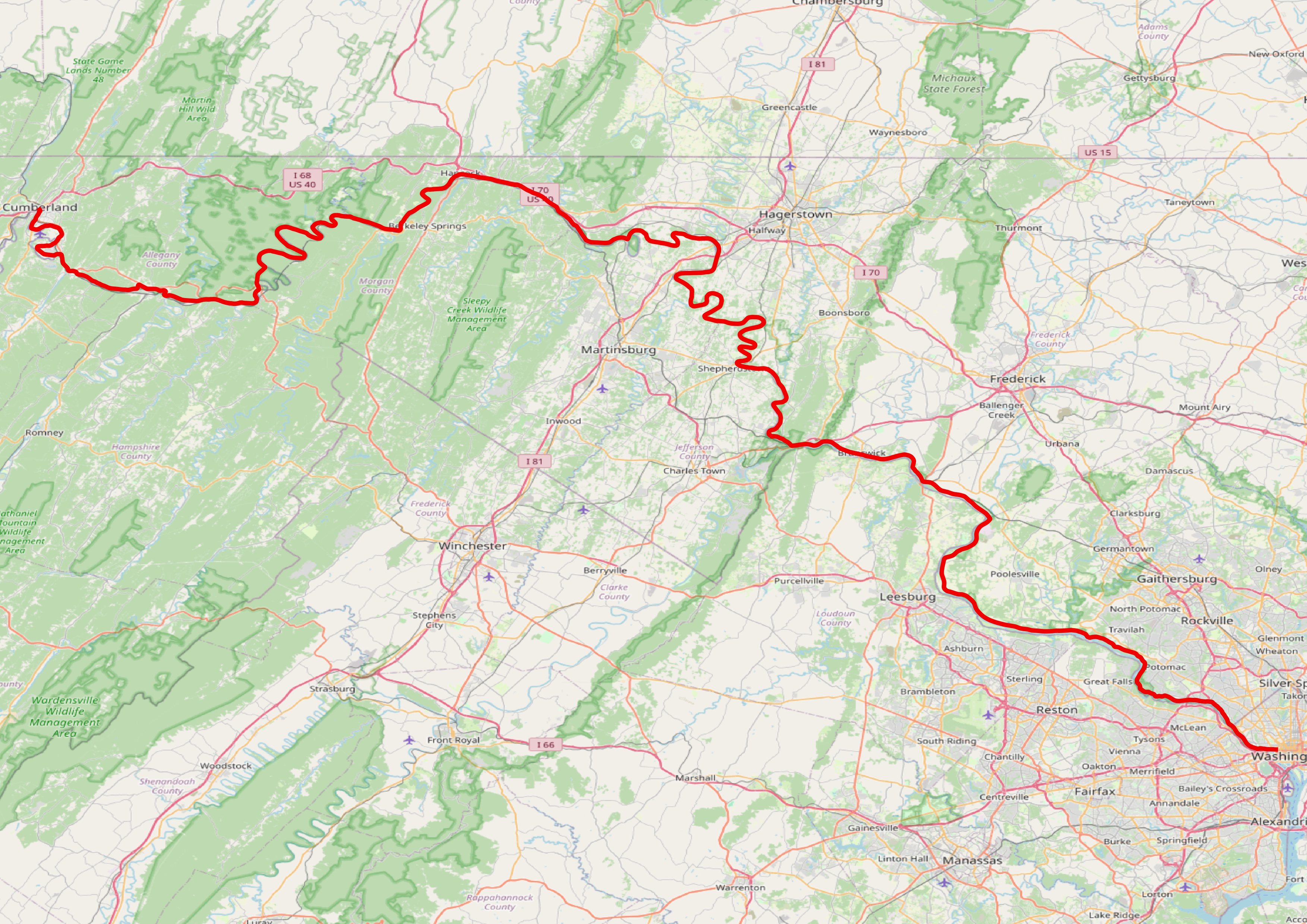
This route is apparently one of the most popular gravel rides in
the country, running all the way from Washington DC to Cumberland
almost exclusively on well-graded gravel trails along the C&O Canal
Trail. Potentially you could go on from Cumberland all the way to
Pittsburgh along the Great Allegheny Passage, which turns this into
a 330 mile route.
[C&O Canal Trail]:
https://bikecando.com/
[Great Allegheny Passage]:
https://gaptrail.org/
I have wondered whether I could do this over a weekend, with one
overnight stop and then taking the Amtrak back from Cumberland to
DC, or vice versa.