TITLE: Thoughts on setting up permanent vegetation monitoring plots
DATE: 2022-02-19
AUTHOR: John L. Godlee
====================================================================
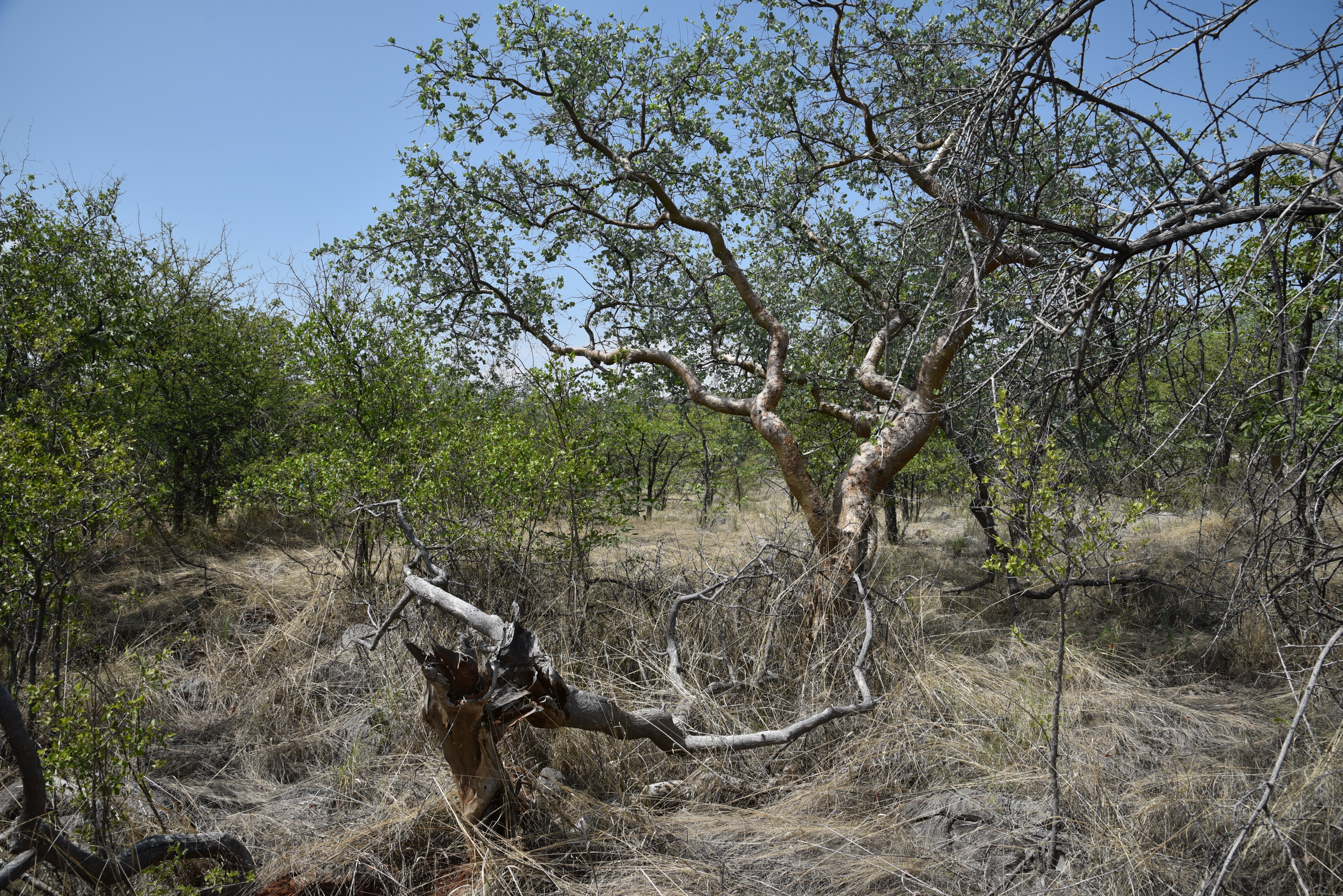
I've been in Namibia trying to find a place to put some permanent
vegetation monitoring plots for the SECO project. These 100x100 m
square plots will be used to monitor woody biomass change in dry
tropical savanna vegetation. There's a lot of factors to consider
when setting up long term plots, so I thought I would write down
some of the things I've been thinking about over the last couple of
weeks.
[SECO]:
https://blogs.ed.ac.uk/seco-project/
Setting up permanent plots requires a lot of investment, both time
and money. The plot boundaries need to be laid out in a very
precise manner, all the stems need to be tagged, the species of all
the trees needs to be recorded, and the stem locations need to be
recorded. Once the plot is set up however, maintaining the plot
requires less work. The plot should have a growth and mortality
census every 3-5 years, any new recruits need to be tagged, and any
damage to the plot like lost tags need to be replaced. At the same
time, the value of the data collected from the plot increases over
time. Repeat censuses help to catch any mistakes during data
collection like misplaced decimal points and incorrect species IDs.
Additionally, longer time series of biomass change tend to be more
representative of long term trends and are more stable than short
time series. So, there's a good reason to make sure that once the
plot is established, every effort is made to keep it going with
regular censuses for as long as possible. Otherwise all that
initial effort is wasted.
To make sure a plot lasts for as long as possible, it's important
to think about accessibility. To make it easy to conduct future
censuses, it's a good idea to put the plot in a location where it's
easy to get to. That means somewhere close to a large population
centre, with roads that don't become impassable during the rainy
season. Of course, this is often at odds with putting the plot
somewhere with natural vegetation, and not on farmland or heavily
grazed pasture. It often also conflicts with the plot being secure.
Plots in remote places are more protected from humans who might
otherwise remove stem tags, or convert the plot to a different land
use.
Another way to ensure that a plot lasts for as long as possible is
to make sure that whoever the land owners or land users are, that
they are properly informed about the purpose of the plot and that
they are on board with having the plot on their land for many
years. Building this trust can take a long time, and the importance
of it shouldn't be under-estimated. It is also a good idea to
discuss with the land owners/users whether the land is likely to
change tenure during the next few years or decades. If the land is
taken over by somebody new, that person might not want the plot
anymore, or they may want to change the plot to a different land
use.
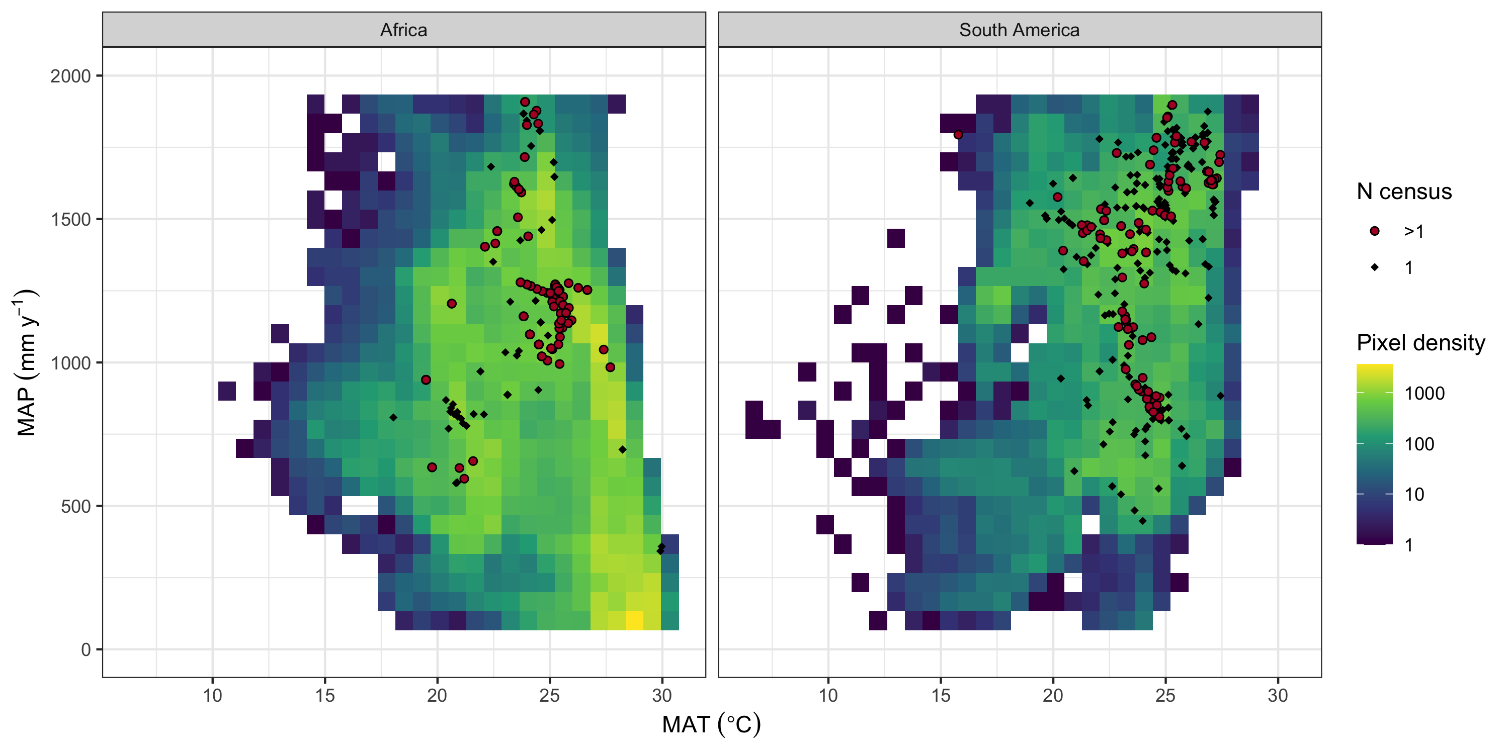
When setting up plots as part of a larger network, it's useful to
know whether the plots add any new information to the network. Do
the new plots occupy a unique climate space, or a unique vegetation
type? If the plots don't add any new information, it might not be
worth expending the effort to set them up.
Decisions about where to put plots are often dictated by existing
relationships with willing collaborators. If the plots are being
set up in a foreign country, it's very helpful to have local
collaborators that can help with the more political side of setting
up plots. Local researchers or consultants will have contacts that
can identify the best places to put plots. Additionally, if a local
educational or conservation institution is involved in the plot set
up, it can make it easier to keep the plots maintained over the
long term.
Once it has been decided where the plots can be set up, it is
important to thoroughly explore the site and figure out where
exactly each plot should be located. It can take days of
exploration with a GPS unit, camera, and notebook, before any plots
are marked out. If the site contains multiple vegetation types, or
has a gradient of stem density, it may be prudent to set up the
plots so that they span this variation across the site.
Plots should normally be set up a decent distance from any roads, a
decent distance from each other, and within homogeneous vegetation
away from the edges of vegetation units. I recommend recording all
the potential plot locations within a site before marking out any
of the plots. I would also recommend recording more potential plot
locations than the number of intended plots, so there are backups
if one of the plot locations becomes unviable later on.