TITLE: Walking three days of the Cleveland Way
DATE: 2021-10-12
AUTHOR: John L. Godlee
====================================================================
The Cleveland Way is a National Trail in the UK, running 109 miles
around the edge of the North York Moors National Park. It starts in
Helmsley, and ends on Filey Brigg, near Filey. It's definitely a
trail in two parts, with the first part mostly on moorland or
through wooded valleys, and the second part along cliffs and
built-up areas by the coast. I walked the in-land part, from
Helmsley to Guisborough. I set off from Helmsley on Sunday in the
early afternoon, and got to Guisborough in the afternoon on Tuesday.
There were lots of people walking the stretch of path closest to
Helmsley. Most of them were coming back towards Helmsley in the
mid-afternoon when I went through. Maybe there's a round walk to
Rievaulx Abbey, which is an impressive ruin of a Cistercian
monastery. There were woodlands with Beech, Ash, and Hazel coppice
along the path edge, and dry stone walls that have become ruined
over time, since the field boundaries were abandoned in favour of a
wire fence. There were some very nice wet dells with ferns and
lichens growing on the tree branches. Reasonable signposting of the
trail except before the Byland turn-off, where many paths meet at
the bottom of a shallow valley.
I cut off a stretch of the official path where it dog legs to the
south to meet the car park at Sutton Bank viewing point, to avoid
people, cars and a road crossing. The shortcut was a bit dull,
across fields and a horse training area, but I didn't miss any
views, as I rejoined Sutton Bank just a bit further along. I hit
the bank as the sun was setting. Bright and clear and blustery,
after the showers had gone the air was crisp. I probably saw my
house from the top of Sutton Bank, but I didn't know where to look.
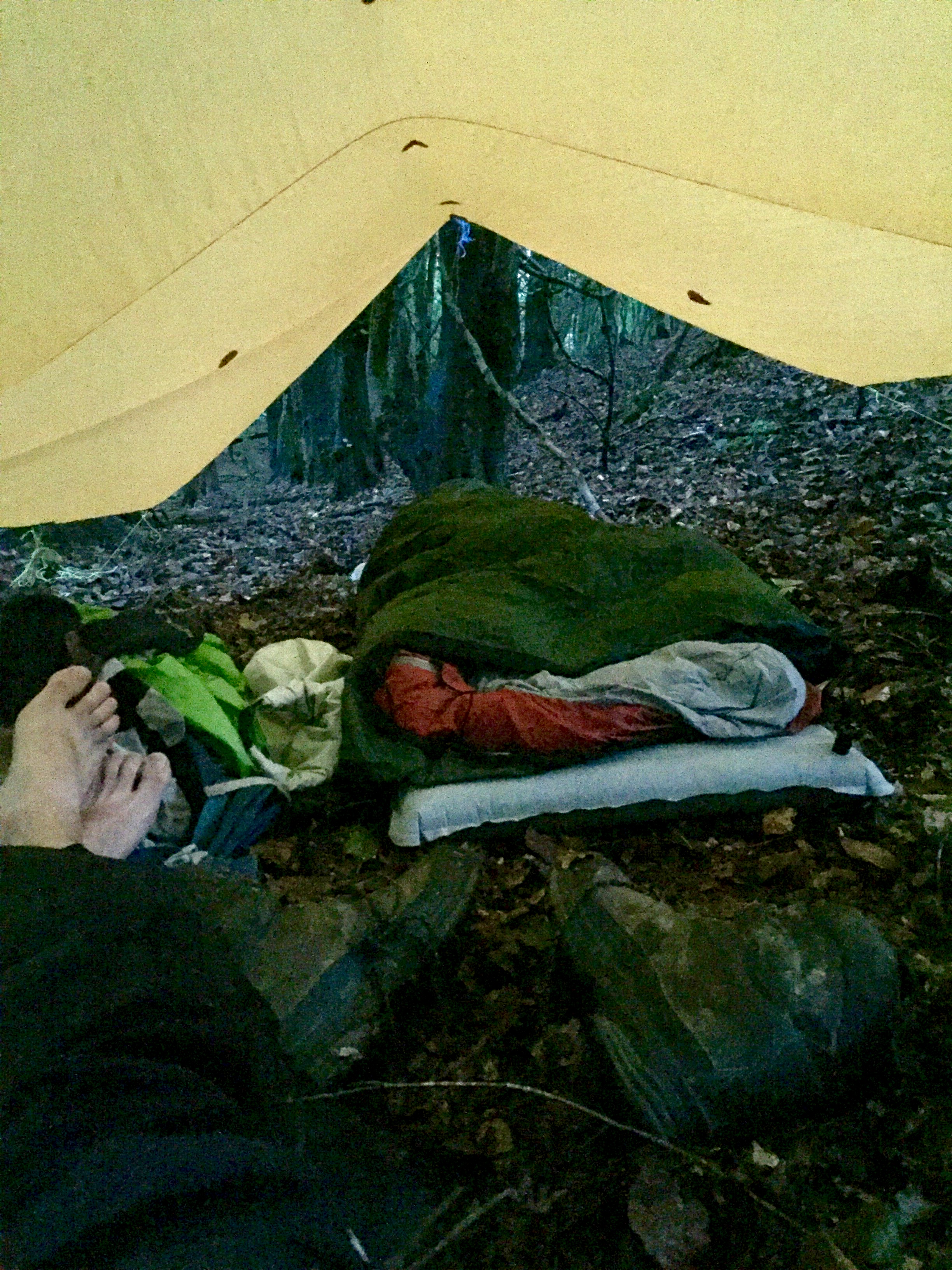
I found a great spot to set up the tarp for camping on the first
night, in some woods up the hill from “Hell Hole” and just to
the south of High Paradise Farm. The woodland patch was owned by
the Forestry commission, with Beech and Larch. I found a good ditch
area where nobody could see me, on soft leaf litter under beech
trees, just up the hill from the main path of the Cleveland Way. I
had to move a few dead branches that were hung up to put my mind at
ease, but really it was pretty sheltered up there on the leeward
side of the wood. In total on the first day, I walked 10.8 miles
(17.4 km).
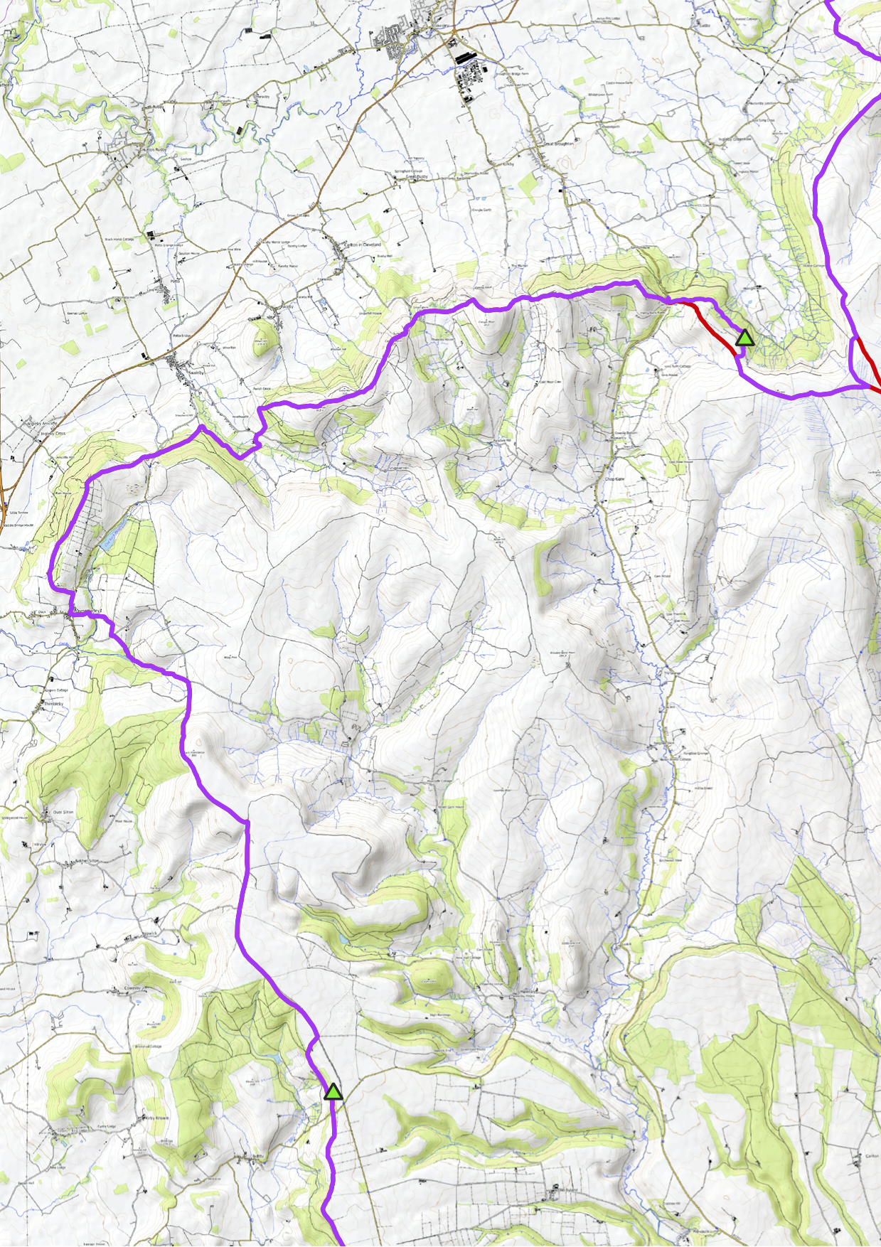
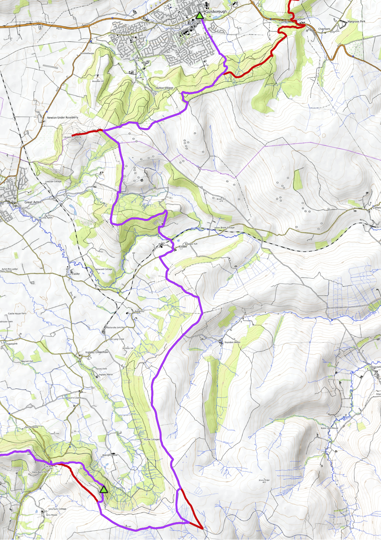
The maps below show my route (purple), the route of the Cleveland
Way (red), and the campsites I found (green triangles).

The next morning the sun rose at about 07:00, and I was away by
08:00. I stole some water from the shower cubicles for campers at
High Paradise Farm. It was very misty and nicely chilly across the
moors. I didn't meet anybody else until I got close to Osmotherley.
I saw lots of grouse and pheasants, all in preparation for shooting
later in the autumn. It seems quite un-sporting when the moors are
stocked that densely. I came across a shooting party primed and
ready to go as I walked into Osmotherley. I had to walk right
through the middle of them to continue along my path. I was lucky
they hadn't started yet as they were shooting right up towards my
path, which seemed pretty dangerous.
I got a cheese sandwich and more water from the village shop at
Osmotherley and pressed on up the hill and back up onto the moors.
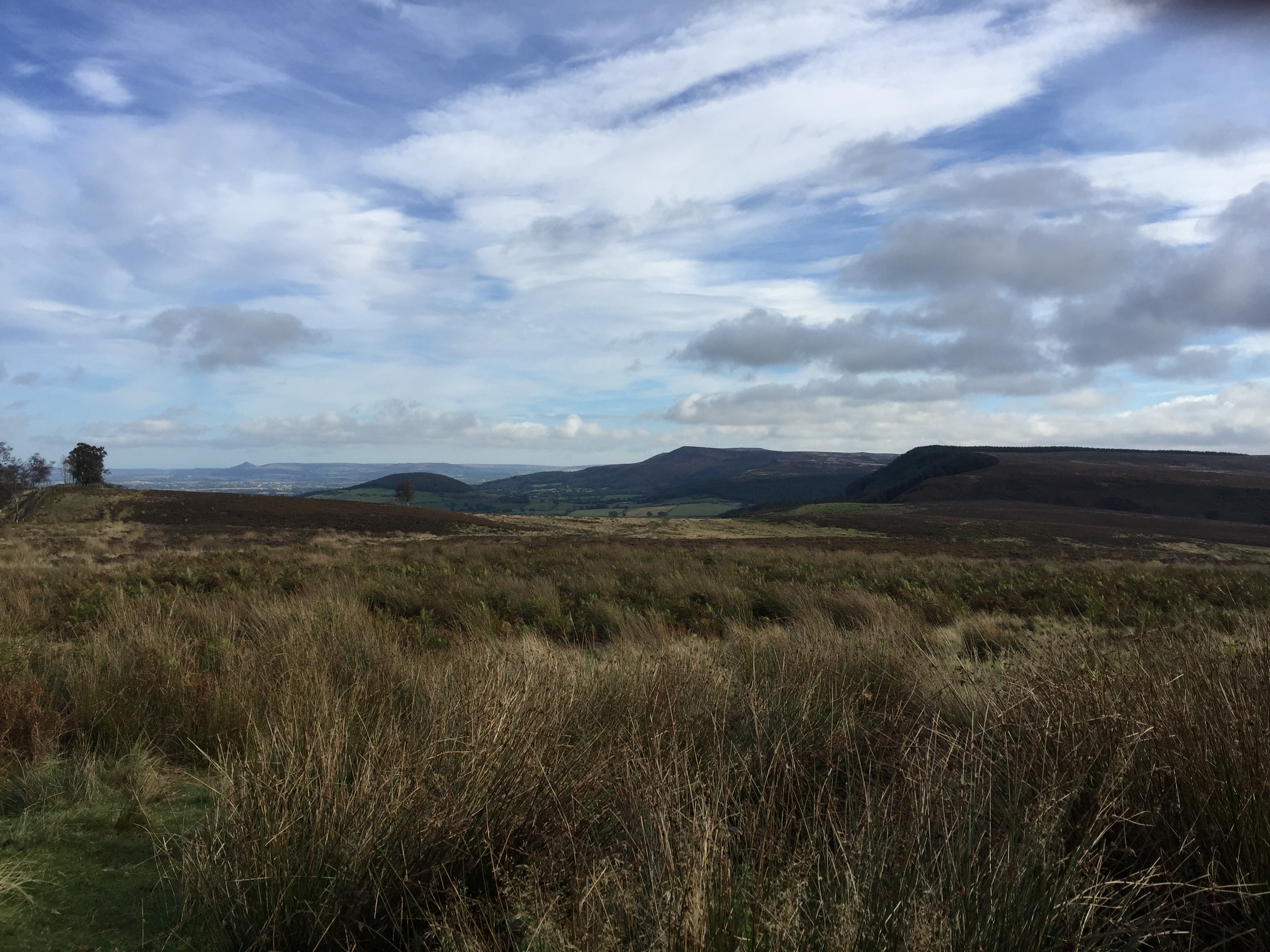
It started to get sunnier throughout the day, and I saw Rosebury
Topping for the first time about midday. Also I saw the infamous
Bilsdale mast, which was damaged by fire a few months ago,
disrupting TV signal across North Yorkshire. I think I also saw one
of the temporary masts at the edge of the cliffs coming out of
Osmotherley, surrounded by greedy diesel generators.
The path started to get more up and down as the day wore on. There
was a nice section going through some woodland with little streams
and damp dells, with big oak trees and ferns. Then just before the
end of the day near Clay Bank there were four rounds of climbing
around 100 m then immediately back down and then back up to the
next peak. Some of the rocky tors on top of the peaks were very
impressive. I saw heavy showers dumping onto Middlesbrough and
Redcar, but I missed all of them except one right at the end of the
day.
After I came down to the car park at Clay Bank, I diverged from the
Cleveland Way to try and find a camping spot in a forestry area
just down at the bottom of what I think was a glacial corrie that
the Cleveland Way ran on top of. I searched for a long time but
most of the patches either had too much bracken, or the trees were
too young and bunched together. By the time I found a spot I was
exhausted. It wasn't a great spot either, quite cramped and on damp
grassy ground among some birch trees. I set up the tarp in a
lean-to style, with one side pegged directly into the ground, the
middle running through a ridge line, and the other side tied to
some trees. I walked a total of about 19.8 miles (31.9 km) on the
second day.
It rained a lot overnight, so I was quite glad I'd set up the tarp
in a more rigid style and closer to the ground. I had to do some
rearrangement in the middle of the night to stop myself getting
splashed though. I used the tarp to collect some water, which I had
run out of, so not all bad.
It stopped raining at about 06:45, just right for me to pack up the
tarp and get back up onto the top of the corrie to rejoin the
Cleveland Way. By coincidence my camping spot was near a steep
footpath that zig-zagged up the corrie. The rain turned it into a
small stream. At the top of the ridge all was in fog. Again that
cool chilly quiet air that I enjoy in the mornings when walking. I
taped up a blister on my left heel and put on a dry sock. I think
I'm getting better at responding to uncomfortable feet before they
develop into worse ailments, but my old boots aren't helping, as
the inside heel is wearing away. While taping up my feet I was
passed by two Geordie men who had all the kit, far too much for a
day hike. They said they were doing an aimless walk on the moorland
access paths back to their car at Clay bank. The North York Moors
has miles of these moorland hardcore paths that are open access for
people on foot, at the deference of the land owners, who mostly
appear to keep for grouse and sheep. I short-cutted a few silly dog
legs on the Cleveland Way using these access paths. On one of them
I found the ruins and information panel for an old engine that used
to lower and raise materials for lead mining in the area, at a
place called Ingleby Bank.
It was very sunny as I made my way towards Kildale, with rainbows
and clear air casting all the way across to Redcar and the sea. I
started having conversations with the sheep about their sheep tick
problems. On the way down to Kildale it was a long and
uncomfortable descent on tarmac, which hurt my feet, particularly
my toes, which got a bit skinned on my right foot.
I sheltered from a rainstorm in the Kildale Memorial Shelter in the
village square, and used the loo at the train station. From there
the weather got markedly worse. It got very wet and cold going up
towards Captain Cook monument, and Rosebury Topping was cloudy, so
I didn't climb it, though I was tired enough by then that I didn't
really want to, so the cloud was a good excuse. I passed some dog
walkers around Captain Cook Monument, but very little else.
Although this final section wasn't actually very long, it took me a
long time, partly because of the rain.
The final bit of track towards Guisborough followed the ridge of
the valley, and through Guisborough woods, which turned out to be a
very active forestry operation. The machines had really torn up the
ground, I reckon about 5 foot deep ruts in some places. Then down
the snakey paths into Guisborough, and into the Fox Inn, which had
a decent deal on a room for the night. Though the room itself was
very basic, and a bit rough around the edges. I loaded up on beer
from Morrison's and got a chicken burger from a take-away shop, and
settled in for some TV. On this final day I walked 16.5 miles (26.6
km).
Predictably, after I'd rung up the pub for a room I found a perfect
camping spot near the bottom of Guisborough woods, on flat ground
under some beautiful big beech trees. I think beech trees are my
favourite type of trees to sleep under. They suppress the
undergrowth and form a soft well drained carpet of leaf litter,
which often bears interesting mushrooms. Still, I'm not sure I
could have easily kept warm in my wet gear this evening, as it is
raining again.