TITLE: Making arty renders of Belize's rivers
DATE: 2018-07-01
AUTHOR: John L. Godlee
====================================================================
y partner spends a lot of time in Belize for work and was looking
for something to hang on her wall as a piece of art. I thought that
a stylised map of Belize could make a nice minimalist piece of art,
but because I have no artistic skills, I decided to do it using R.
I got some shapefiles to start with:
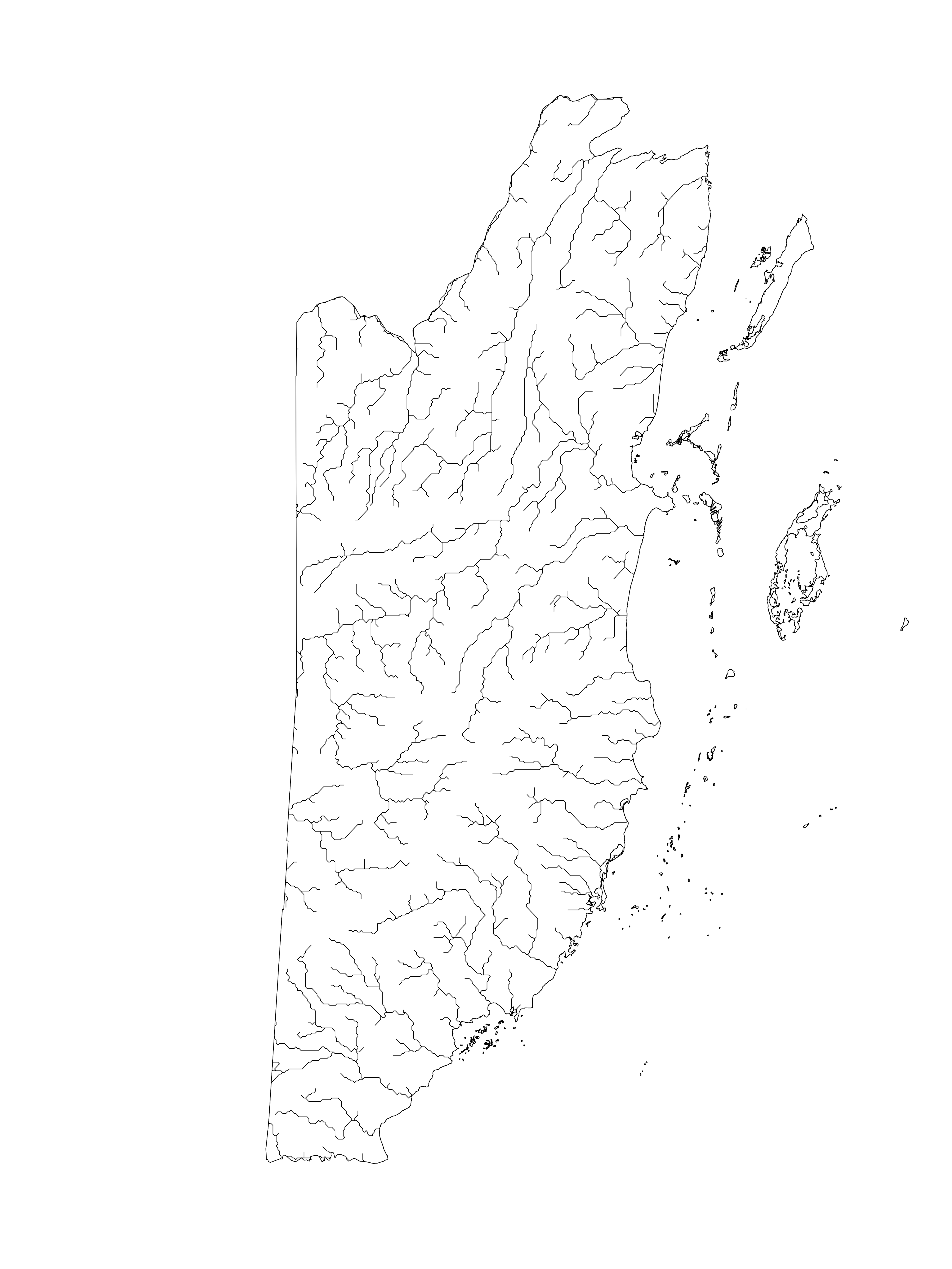
- A simple global river bankfull width and depth database - For
the rivers
- GADM Data - Outline of Belize
[A simple global river bankfull width and depth database]:
https://agupubs.onlinelibrary.wiley.com/doi/full/10.1002/wrcr.20440
[GADM Data]:
https://gadm.org/download_country_v3.html
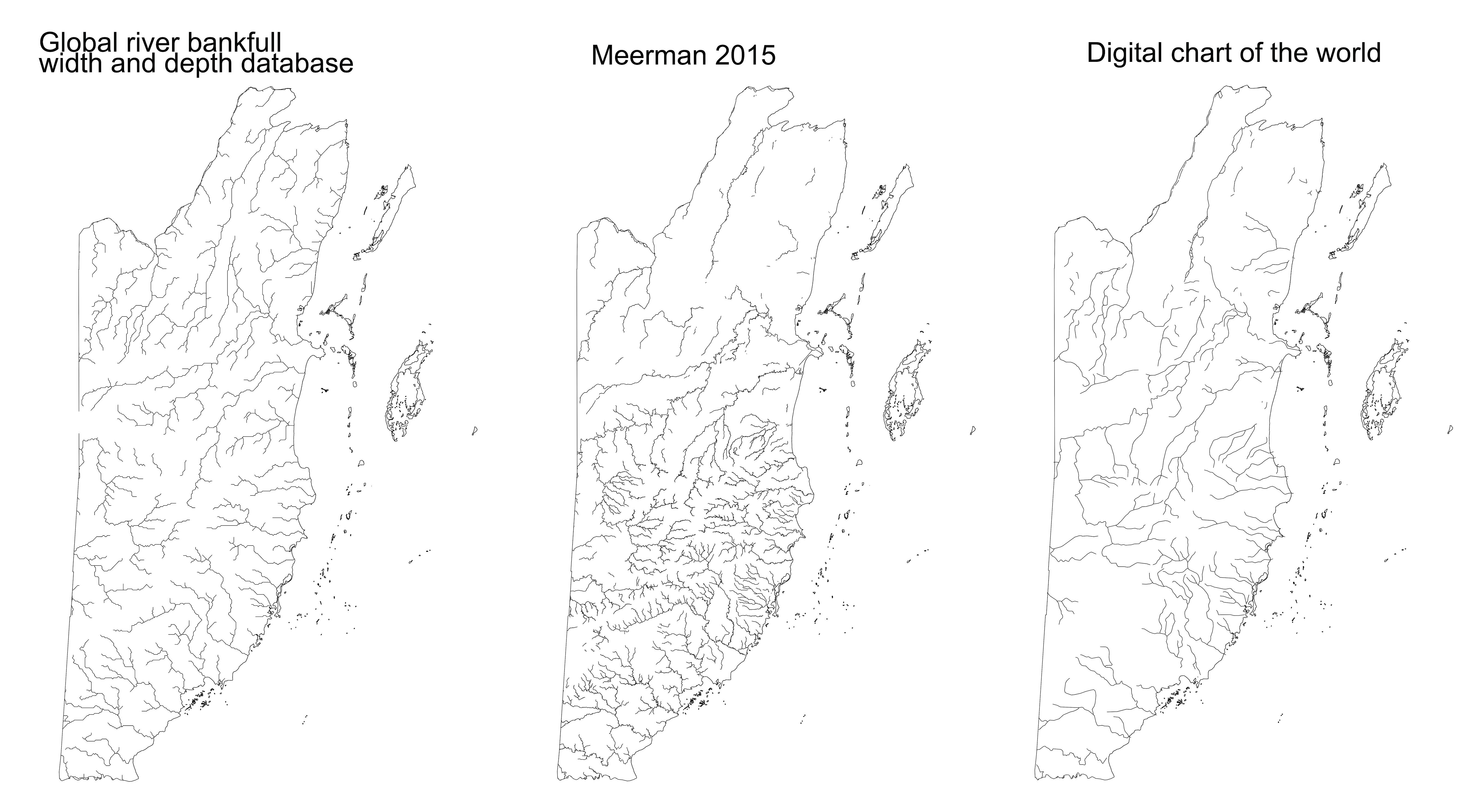
I also experimented with other shapefiles of rivers in Belize, but
the one above is the one I preferred, mainly because it has
slightly angular lines. These are the other sources I looked at:
- Meerman 2015
- Digital Chart of the World - Inland Water
[Meerman 2015]:
http://www.biodiversity.bz/
[Digital Chart of the World - Inland Water]:
http://www.diva-gis.org/gdata
Here is the R code that I used to create the map output. I saved it
as an svg for printing and also as a png for previewing:
# Packages ----
library(rgdal)
library(raster)
# Add shapefiles ----
belize <- readOGR(dsn = "BLZ_adm", layer = "BLZ_adm0")
rivers_1 <- readOGR(dsn = "camerica", layer = "carivs")
rivers_2 <- readOGR(dsn = "Belize_Rivers 2", layer =
"Belize_Rivers")
rivers_3 <- readOGR(dsn = "BLZ_wat", layer =
"BLZ_water_lines_dcw")
watersheds <- readOGR(dsn = "Belize_Watersheds", layer =
"Belize_Watersheds")
# Fix shapefiles ----
## Transform rivers_2 to wgs84 CRS
rivers_2_wgs84 <- spTransform(rivers_2, CRS("+proj=longlat
+datum=WGS84 +no_defs +ellps=WGS84 +towgs84=0,0,0"))
# rivers_1 ----
## Filter out rivers not in Belize
rivers_1_belize <- crop(rivers_1, belize)
## Save as .svg
svg(filename = "img/svg/rivers_1_belize.svg", width = 15,
height = 20, onefile = TRUE)
plot(rivers_1_belize)
plot(belize, add = TRUE)
dev.off()
## Filter out small rivers according to bank full width
rivers_1_big <- rivers_1_belize[rivers_1_belize$a_WIDTH >
quantile(rivers_1_belize$a_WIDTH, 0.50), ]
## Save as .svg
svg(filename = "img/svg/rivers_1_big.svg", width = 15, height =
20, onefile = TRUE)
plot(rivers_1_big)
plot(belize, add = TRUE)
dev.off()
# rivers_2 ----
## Filter streams that are more than 2nd order, or 3rd order
rivers_2_first <- rivers_2_wgs84[rivers_2_wgs84$Strm_order > 1,
]
rivers_2_second <- rivers_2_wgs84[rivers_2_wgs84$Strm_order >
2, ]
## Crop to belize outline
rivers_2_first_belize <- crop(rivers_2_first, belize)
rivers_2_second_belize <- crop(rivers_2_second, belize)
## Write as shapefiles because the cropping took a long time
writeOGR(obj=rivers_2_first_belize,
dsn="belize_rivers_2_first_crop",
layer="belizer_rivers_2_first_crop", driver="ESRI Shapefile")
writeOGR(obj=rivers_2_second_belize,
dsn="belize_rivers_2_second_crop",
layer="belizer_rivers_2_second_crop", driver="ESRI Shapefile")
## Save as .svg
svg(filename = "img/svg/rivers_2_wgs84.svg", width = 15, height
= 20, onefile = TRUE)
plot(rivers_2_wgs84)
plot(belize, add = TRUE)
dev.off()
svg(filename = "img/svg/rivers_2_first_belize.svg", width = 15,
height = 20, onefile = TRUE)
plot(rivers_2_first_belize)
plot(belize, add = TRUE)
dev.off()
svg(filename = "img/svg/rivers_2_second_belize.svg", width =
15, height = 20, onefile = TRUE)
plot(rivers_2_second_belize)
plot(belize, add = TRUE)
dev.off()
# rivers 3 ----
## Save as .svg
svg(filename = "img/svg/rivers_3.svg", width = 15, height = 20,
onefile = TRUE)
plot(rivers_3)
plot(belize, add = TRUE)
dev.off()
I'm printing off the big file next week, then I want to frame it in
a thin black edge frame with glossy glass.